Approximate Location Map
Large Map »
Latitude: 51.1515 / 51°9'5"N
Longitude: 0.6959 / 0°41'45"E
OS Eastings: 588638
OS Northings: 142595
OS Grid: TQ886425
Mapcode National: GBR QV4.NRX
Mapcode Global: VHKKK.0BQ2
Plus Code: 9F325M2W+J9
Entry Name: Stanley House
Listing Date: 10 October 1980
Grade: II
Source: Historic England
Source ID: 1107171
English Heritage Legacy ID: 181215
ID on this website: 101107171
Location: Biddenden Green, Ashford, Kent, TN27
County: Kent
District: Ashford
Civil Parish: Smarden
Built-Up Area: Smarden
Traditional County: Kent
Lieutenancy Area (Ceremonial County): Kent
Tagged with: House
1.
5272 SMARDEN PLUCKLEY ROAD
Stanley House
TQ 8842 29/30
II
2.
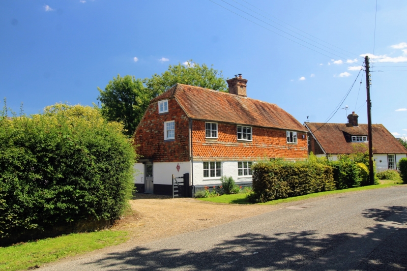
C17 or earlier timber-framed building refaced with brick, now painted on the
ground floor and tile-hung above, mainly with curved tiles. Half-hipped tiled
roof. Three casement windows. Doorcase with flat hood over.
Listing NGR: TQ8863842595
External links are from the relevant listing authority and, where applicable, Wikidata. Wikidata IDs may be related buildings as well as this specific building. If you want to add or update a link, you will need to do so by editing the Wikidata entry.


Other nearby listed buildings
