Approximate Location Map
Large Map »
Latitude: 51.1506 / 51°9'2"N
Longitude: 0.6936 / 0°41'37"E
OS Eastings: 588484
OS Northings: 142491
OS Grid: TQ884424
Mapcode National: GBR QV4.VJW
Mapcode Global: VHJN2.ZB1S
Plus Code: 9F325M2V+7C
Entry Name: Jubilee House
Listing Date: 14 February 1967
Grade: II
Source: Historic England
Source ID: 1362702
English Heritage Legacy ID: 181216
ID on this website: 101362702
Location: Biddenden Green, Ashford, Kent, TN27
County: Kent
District: Ashford
Civil Parish: Smarden
Built-Up Area: Smarden
Traditional County: Kent
Lieutenancy Area (Ceremonial County): Kent
Tagged with: House
1.
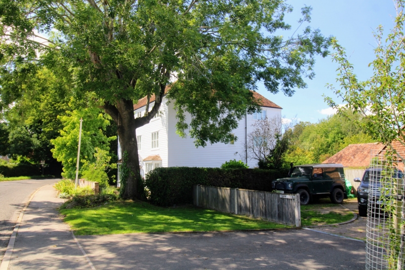
5272 SMARDEN PLUCKLEY ROAD
Jubilee House
TQ 8842 29/29
II
2.
C18. Three storeys faced with weatherboarding. Hipped tiled roof with modillion
eaves cornice. Three casement windows. Doorcase in moulded and shouldered
architrave surround, with pediment over on brackets and door of 6 fielded panels.
Listing NGR: TQ8848442491
External links are from the relevant listing authority and, where applicable, Wikidata. Wikidata IDs may be related buildings as well as this specific building. If you want to add or update a link, you will need to do so by editing the Wikidata entry.


Other nearby listed buildings
