Approximate Location Map
Large Map »
Latitude: 51.1559 / 51°9'21"N
Longitude: 0.7209 / 0°43'15"E
OS Eastings: 590369
OS Northings: 143152
OS Grid: TQ903431
Mapcode National: GBR QV5.H2L
Mapcode Global: VHKKK.F6ZP
Plus Code: 9F325P4C+99
Entry Name: Maltman's Hill Farmhouse
Listing Date: 14 February 1967
Grade: II
Source: Historic England
Source ID: 1107937
English Heritage Legacy ID: 181226
ID on this website: 101107937
Location: Maltman's Hill, Ashford, Kent, TN27
County: Kent
District: Ashford
Civil Parish: Smarden
Traditional County: Kent
Lieutenancy Area (Ceremonial County): Kent
Tagged with: Farmhouse
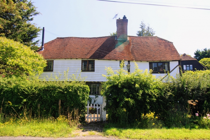
1.
5272 SMARDEN PLUCKLEY ROAD
Maltman's Hill
Maltman's Hill Farmhouse
TQ 94 SW 14/86 14.2.67.
II
2.
C16 or earlier timber-framed building with plaster infilling, the north half
of the first floor oversailing on the protruding ends of the floor joists and
brackets, and weatherboarded. Half-hipped tiled roof. Three casement windows.
Listing NGR: TQ9036943152
External links are from the relevant listing authority and, where applicable, Wikidata. Wikidata IDs may be related buildings as well as this specific building. If you want to add or update a link, you will need to do so by editing the Wikidata entry.


Other nearby listed buildings
