Approximate Location Map
Large Map »
Latitude: 51.166 / 51°9'57"N
Longitude: 0.6937 / 0°41'37"E
OS Eastings: 588424
OS Northings: 144202
OS Grid: TQ884442
Mapcode National: GBR QTY.VK2
Mapcode Global: VHJMW.ZY2H
Plus Code: 9F325M8V+CF
Entry Name: Pear Tree Cottage
Listing Date: 10 October 1980
Grade: II
Source: Historic England
Source ID: 1362726
English Heritage Legacy ID: 181249
ID on this website: 101362726
Location: The Quarter, Ashford, Kent, TN27
County: Kent
District: Ashford
Civil Parish: Smarden
Traditional County: Kent
Lieutenancy Area (Ceremonial County): Kent
Tagged with: Cottage
1.
5272 SMARDEN SMARDEN BELL ROAD
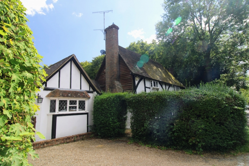
Pear Tree Cottage
TQ 84 SE 13/46
II
2.
A late mediaeval restored timber-framed building, with plaster infilling and
curved braces on the first floor. Tiled roof. Two casement windows.
Listing NGR: TQ8842444202
External links are from the relevant listing authority and, where applicable, Wikidata. Wikidata IDs may be related buildings as well as this specific building. If you want to add or update a link, you will need to do so by editing the Wikidata entry.


Other nearby listed buildings
