Approximate Location Map
Large Map »
Latitude: 51.1634 / 51°9'48"N
Longitude: 0.6902 / 0°41'24"E
OS Eastings: 588196
OS Northings: 143906
OS Grid: TQ881439
Mapcode National: GBR QTY.TKZ
Mapcode Global: VHJN2.X08Y
Plus Code: 9F325M7R+93
Entry Name: Littlegates
Listing Date: 14 February 1967
Grade: II
Source: Historic England
Source ID: 1071356
English Heritage Legacy ID: 181251
ID on this website: 101071356
Location: The Quarter, Ashford, Kent, TN27
County: Kent
District: Ashford
Civil Parish: Smarden
Traditional County: Kent
Lieutenancy Area (Ceremonial County): Kent
Tagged with: Building
1.
5272 SMARDEN SMARDEN BELL ROAD
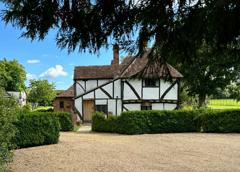
Littlegates
TQ 84 SE 13/48 14.2.67.
II
2.
C16 or earlier restored timber-framed of 2 storeys with plaster infilling,
the first floor of the west front oversailing on the protruding ends of the
floor joists and brackets and with curved braces. Hipped tiled roof. Three
casement windows with small square leaded panes.
Listing NGR: TQ8819643906
External links are from the relevant listing authority and, where applicable, Wikidata. Wikidata IDs may be related buildings as well as this specific building. If you want to add or update a link, you will need to do so by editing the Wikidata entry.


Other nearby listed buildings
