Approximate Location Map
Large Map »
Latitude: 51.136 / 51°8'9"N
Longitude: 0.6731 / 0°40'23"E
OS Eastings: 587110
OS Northings: 140809
OS Grid: TQ871408
Mapcode National: GBR QV9.P0Q
Mapcode Global: VHJN2.MQ60
Plus Code: 9F324MPF+97
Entry Name: Kelsham Farmhouse
Listing Date: 10 October 1980
Grade: II
Source: Historic England
Source ID: 1359675
English Heritage Legacy ID: 181274
ID on this website: 101359675
Location: Tylden, Ashford, Kent, TN27
County: Kent
District: Ashford
Civil Parish: Smarden
Traditional County: Kent
Lieutenancy Area (Ceremonial County): Kent
Tagged with: Farmhouse
1.
5272 SMARDEN TILDEN
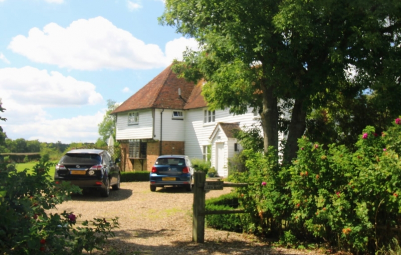
Kelsham Farmhouse
TQ 84 SE 13/96
II
2.
Probably a late mediaeval hall-house. L-shaped. The left-hand portion is
of 2 storeys. Ground floor red brick, first floor weatherboarded with jettied
overhang. Hipped old tiled roof. The right-hand portion is probably C18.
Tow storeys weatherboarded. Hipped tield roof. Two casements. Weather porch.
Listing NGR: TQ8711040809
External links are from the relevant listing authority and, where applicable, Wikidata. Wikidata IDs may be related buildings as well as this specific building. If you want to add or update a link, you will need to do so by editing the Wikidata entry.


Other nearby listed buildings
