Approximate Location Map
Large Map »
Latitude: 51.1496 / 51°8'58"N
Longitude: 0.6868 / 0°41'12"E
OS Eastings: 588009
OS Northings: 142356
OS Grid: TQ880423
Mapcode National: GBR QV4.SK7
Mapcode Global: VHJN2.VCFL
Plus Code: 9F324MXP+RP
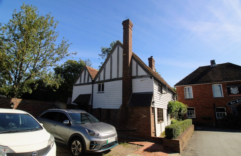
Entry Name: Wistaria Cottage
Listing Date: 10 October 1980
Grade: II
Source: Historic England
Source ID: 1071365
English Heritage Legacy ID: 181279
ID on this website: 101071365
Location: Smarden, Ashford, Kent, TN27
County: Kent
District: Ashford
Civil Parish: Smarden
Built-Up Area: Smarden
Traditional County: Kent
Lieutenancy Area (Ceremonial County): Kent
Tagged with: Cottage
1.
5272 SMARDEN WATER LANE
(north-west side)
Wisteria Cottage
TQ 8842 29/15A
II
2.
C17 or earlier restored timber-framed cottage, with cemented infilling, the
first floor weaterboarded. Tiled roof. Two casement windows.
Listing NGR: TQ8800942353
External links are from the relevant listing authority and, where applicable, Wikidata. Wikidata IDs may be related buildings as well as this specific building. If you want to add or update a link, you will need to do so by editing the Wikidata entry.


Other nearby listed buildings
