Approximate Location Map
Large Map »
Latitude: 51.1538 / 51°9'13"N
Longitude: 0.6794 / 0°40'45"E
OS Eastings: 587474
OS Northings: 142812
OS Grid: TQ874428
Mapcode National: GBR QV3.QKL
Mapcode Global: VHJN2.Q8J9
Plus Code: 9F325M3H+GP
Entry Name: Fuller Barn Cottage
Listing Date: 10 October 1980
Grade: II
Source: Historic England
Source ID: 1362713
English Heritage Legacy ID: 181284
ID on this website: 101362713
Location: Smarden Bell, Ashford, Kent, TN27
County: Kent
District: Ashford
Civil Parish: Smarden
Traditional County: Kent
Lieutenancy Area (Ceremonial County): Kent
Tagged with: Cottage
1.
5272 SMARDEN WATER LANE
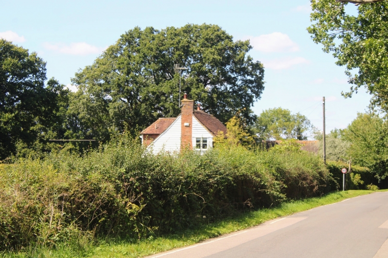
Fuller Barn Cottage
TQ 8742 23/113
II
2.
C18. Two storeys. Ground floor weatherboarded, first floor tile-hung. Tiled
roof, half-hipped at one end. Three altered casements. Trellised weather
porch.
Listing NGR: TQ8747442812
External links are from the relevant listing authority and, where applicable, Wikidata. Wikidata IDs may be related buildings as well as this specific building. If you want to add or update a link, you will need to do so by editing the Wikidata entry.


Other nearby listed buildings
