Approximate Location Map
Large Map »
Latitude: 51.2097 / 51°12'34"N
Longitude: 0.9584 / 0°57'30"E
OS Eastings: 606734
OS Northings: 149767
OS Grid: TR067497
Mapcode National: GBR SXK.33T
Mapcode Global: VHKK9.KVJJ
Plus Code: 9F326X55+V9
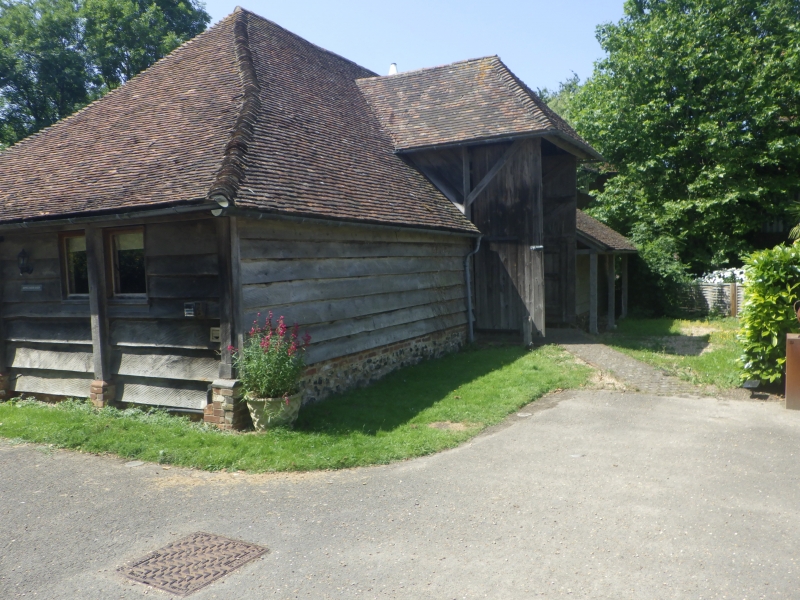
Entry Name: Barn 15 Yards South East of Ripple Farmhouse
Listing Date: 13 August 1984
Grade: II
Source: Historic England
Source ID: 1362759
English Heritage Legacy ID: 181506
ID on this website: 101362759
Location: Godmersham, Ashford, Kent, CT4
County: Kent
District: Ashford
Civil Parish: Crundale
Traditional County: Kent
Lieutenancy Area (Ceremonial County): Kent
Tagged with: Barn
TR 04 NE CRUNDALE
6/4 Barn 15 yards south-
east of Ripple Farmhouse
GV II
Barn. Dated 1742 on beam. Timber framed and clad in weatherboard
on flint and brick plinth, and plain tile hipped roof. Hipped mid-
stray; catslide roof to left. Interior: 4 bays with aisles; clasped
purlin roof. Included for group value only.
Listing NGR: TR0671449776
External links are from the relevant listing authority and, where applicable, Wikidata. Wikidata IDs may be related buildings as well as this specific building. If you want to add or update a link, you will need to do so by editing the Wikidata entry.


Other nearby listed buildings
