Approximate Location Map
Large Map »
Latitude: 54.152 / 54°9'7"N
Longitude: -2.7302 / 2°43'48"W
OS Eastings: 352407
OS Northings: 473152
OS Grid: SD524731
Mapcode National: GBR 9NCF.QD
Mapcode Global: WH83P.1W6X
Plus Code: 9C6V5729+QW
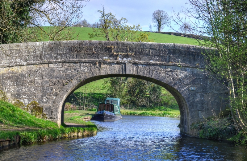
Entry Name: Lancaster Canal Sanders Bridge (Number 136)
Listing Date: 7 November 1983
Grade: II
Source: Historic England
Source ID: 1362422
English Heritage Legacy ID: 181803
ID on this website: 101362422
Location: Borwick, Lancaster, Lancashire, LA6
County: Lancashire
District: Lancaster
Civil Parish: Borwick
Traditional County: Lancashire
Lieutenancy Area (Ceremonial County): Lancashire
Church of England Parish: Warton St Oswald (or Holy Trinity)
Church of England Diocese: Blackburn
Tagged with: Architectural structure
SD 57 SW BORWICK
4/61 Sanders Bridge, (No. 136)
II
Bridge over the Lancaster Canal, opened in 1797. Sandstone blocks. Single
elliptical arch with projecting keystone, string, and solid coping with
rounded top.
Listing NGR: SD5241173153
External links are from the relevant listing authority and, where applicable, Wikidata. Wikidata IDs may be related buildings as well as this specific building. If you want to add or update a link, you will need to do so by editing the Wikidata entry.


Other nearby listed buildings
