Approximate Location Map
Large Map »
Latitude: 54.162 / 54°9'43"N
Longitude: -2.7618 / 2°45'42"W
OS Eastings: 350353
OS Northings: 474291
OS Grid: SD503742
Mapcode National: GBR 9N49.WS
Mapcode Global: WH83N.KN26
Plus Code: 9C6V566Q+R7
Entry Name: 10, Yealand Road
Listing Date: 7 November 1983
Grade: II
Source: Historic England
Source ID: 1071844
English Heritage Legacy ID: 182051
ID on this website: 101071844
Location: Yealand Conyers, Lancaster, Lancashire, LA5
County: Lancashire
District: Lancaster
Civil Parish: Yealand Conyers
Traditional County: Lancashire
Lieutenancy Area (Ceremonial County): Lancashire
Church of England Parish: Yealand Conyers St John The Evangelist
Church of England Diocese: Blackburn
Tagged with: Building
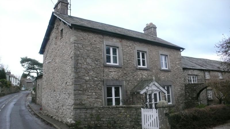
SD 57 SW YEALAND CONYERS YEALAND ROAD (EAST SIDE)
4/281 No. 10
GV II
House, mid C19th. Pebbledashed rubble with slate roof. Central-entry plan
with gable stacks. 2 storeys, 3 bays. Windows modern in plain limestone
surrounds. Gabled porch with modern door. Eaves overhanging and bracketed
at gables.
Listing NGR: SD5035374291
External links are from the relevant listing authority and, where applicable, Wikidata. Wikidata IDs may be related buildings as well as this specific building. If you want to add or update a link, you will need to do so by editing the Wikidata entry.


Other nearby listed buildings
