Approximate Location Map
Large Map »
Latitude: 53.9989 / 53°59'56"N
Longitude: -2.7849 / 2°47'5"W
OS Eastings: 348644
OS Northings: 456164
OS Grid: SD486561
Mapcode National: GBR 8QZ6.W7
Mapcode Global: WH84F.6R36
Plus Code: 9C5VX6X8+H2
Entry Name: Sundial in Graveyard
Listing Date: 7 March 1985
Grade: II
Source: Historic England
Source ID: 1317857
English Heritage Legacy ID: 182172
ID on this website: 101317857
Location: Ellel, Lancaster, Lancashire, LA2
County: Lancashire
District: Lancaster
Civil Parish: Ellel
Traditional County: Lancashire
Lieutenancy Area (Ceremonial County): Lancashire
Church of England Parish: Ellel St John The Evangelist
Church of England Diocese: Blackburn
Tagged with: Sundial
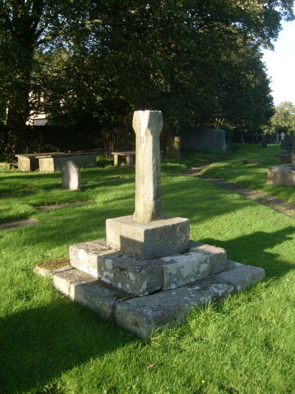
SD 45 NE ELLEL CHURCH LANE
8/108 Sundial in graveyard
GV II
Sundial, possible c.1800 with shaft of C17th type. Sandstone. Base of 3
steps, square on plan. Shaft of square plan with chamfered sides. Brass
plate has broken gnomon. The graveyard is the site of an earlier church,
built c.1800, replaced in 1907 and demolished in 1936.
Listing NGR: SD4864456164
External links are from the relevant listing authority and, where applicable, Wikidata. Wikidata IDs may be related buildings as well as this specific building. If you want to add or update a link, you will need to do so by editing the Wikidata entry.


Other nearby listed buildings
