Approximate Location Map
Large Map »
Latitude: 54.0146 / 54°0'52"N
Longitude: -2.8066 / 2°48'23"W
OS Eastings: 347240
OS Northings: 457917
OS Grid: SD472579
Mapcode National: GBR 8QV0.5N
Mapcode Global: WH84D.VCP6
Plus Code: 9C6V257V+R8
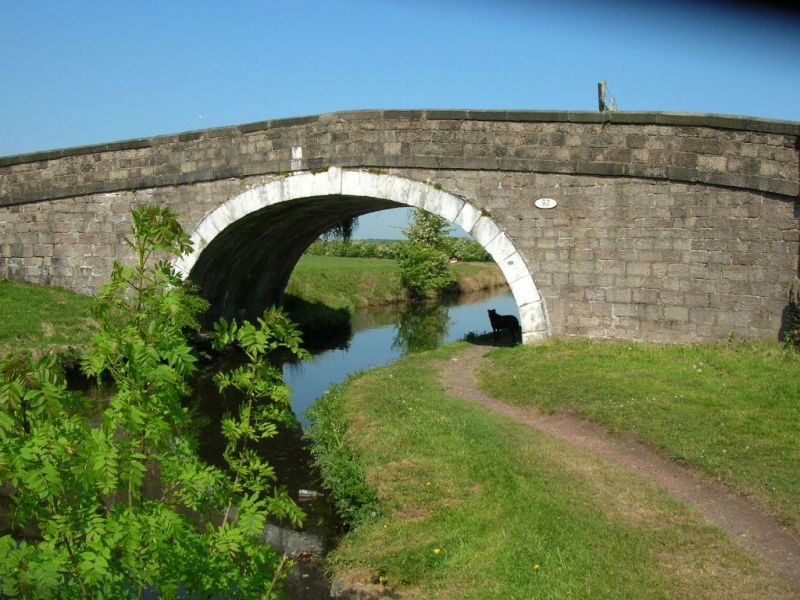
Entry Name: Burrow Beck Bridge (NO.92)
Listing Date: 7 March 1985
Grade: II
Source: Historic England
Source ID: 1317731
English Heritage Legacy ID: 182269
ID on this website: 101317731
Location: Stodday, Lancaster, Lancashire, LA2
County: Lancashire
District: Lancaster
Civil Parish: Thurnham
Traditional County: Lancashire
Lieutenancy Area (Ceremonial County): Lancashire
Church of England Parish: Lancaster St Paul
Church of England Diocese: Blackburn
Tagged with: Bridge
SD 45 NE THURNHAM
8/202 Burrow Beck Bridge (No.92)
II
Accommodation bridge over Lancaster Canal, opened 1797. Engineer
John Rennie. Punched sandstone blocks. Single elliptical arch with stepped
keystone. Solid parapet with string course and rounded coping.
Listing NGR: SD4724057917
External links are from the relevant listing authority and, where applicable, Wikidata. Wikidata IDs may be related buildings as well as this specific building. If you want to add or update a link, you will need to do so by editing the Wikidata entry.


Other nearby listed buildings
