Approximate Location Map
Large Map »
Latitude: 53.985 / 53°59'5"N
Longitude: -2.8141 / 2°48'50"W
OS Eastings: 346712
OS Northings: 454631
OS Grid: SD467546
Mapcode National: GBR 8QSC.K7
Mapcode Global: WH84L.R34C
Plus Code: 9C5VX5MP+X9
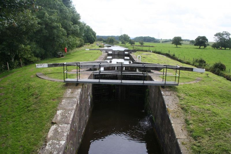
Entry Name: Fourth Lock
Listing Date: 7 March 1985
Grade: II
Source: Historic England
Source ID: 1164602
English Heritage Legacy ID: 182278
ID on this website: 101164602
Location: Upper Thurnham, Lancaster, Lancashire, LA2
County: Lancashire
District: Lancaster
Civil Parish: Thurnham
Traditional County: Lancashire
Lieutenancy Area (Ceremonial County): Lancashire
Church of England Parish: Glasson Christ Church
Church of England Diocese: Blackburn
Tagged with: Architectural structure Lock
SD 45 SE THURNHAM
12/211 Fourth Lock
-
- II
Lock over Glasson Branch of Lancaster Canal, built 1823-5. Sandstone ashlar.
Complete with 2 pairs of timber gates.
Listing NGR: SD4671254631
External links are from the relevant listing authority and, where applicable, Wikidata. Wikidata IDs may be related buildings as well as this specific building. If you want to add or update a link, you will need to do so by editing the Wikidata entry.


Other nearby listed buildings
