Approximate Location Map
Large Map »
Latitude: 53.9919 / 53°59'30"N
Longitude: -2.8237 / 2°49'25"W
OS Eastings: 346091
OS Northings: 455410
OS Grid: SD460554
Mapcode National: GBR 8QQ8.GR
Mapcode Global: WH84D.LXLM
Plus Code: 9C5VX5RG+QG
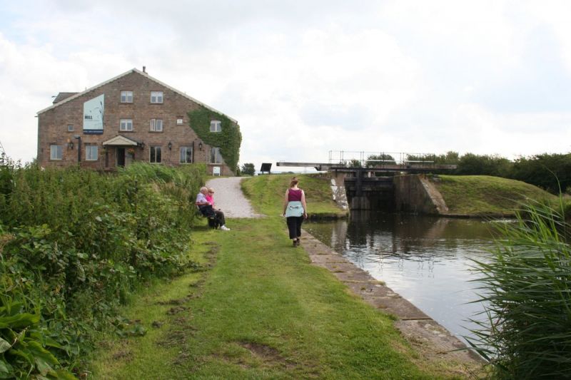
Entry Name: Sixth Lock
Listing Date: 7 March 1985
Grade: II
Source: Historic England
Source ID: 1317708
English Heritage Legacy ID: 182280
ID on this website: 101317708
Location: Lower Thurnham, Lancaster, Lancashire, LA2
County: Lancashire
District: Lancaster
Civil Parish: Thurnham
Traditional County: Lancashire
Lieutenancy Area (Ceremonial County): Lancashire
Church of England Parish: Glasson Christ Church
Church of England Diocese: Blackburn
Tagged with: Lock
SD 45 NE THURNHAM
8/212 Sixth Lock
- II
Local over Glasson Branch of Lancaster Canal, built 1823-5. Sandstone ashlar.
Complete with 2 pairs of timber gates.
Listing NGR: SD4609155410
External links are from the relevant listing authority and, where applicable, Wikidata. Wikidata IDs may be related buildings as well as this specific building. If you want to add or update a link, you will need to do so by editing the Wikidata entry.


Other nearby listed buildings
