Approximate Location Map
Large Map »
Latitude: 54.1839 / 54°11'1"N
Longitude: -2.5616 / 2°33'41"W
OS Eastings: 363447
OS Northings: 476601
OS Grid: SD634766
Mapcode National: GBR BNK1.6Y
Mapcode Global: WH94W.M3DD
Plus Code: 9C6V5CMQ+H9
Entry Name: Cowan Bridge
Listing Date: 4 December 1985
Grade: II
Source: Historic England
Source ID: 1071707
English Heritage Legacy ID: 182340
ID on this website: 101071707
Location: Overtown, Lancaster, Lancashire, LA6
County: Lancashire
District: Lancaster
Civil Parish: Burrow-with-Burrow
Traditional County: Lancashire
Lieutenancy Area (Ceremonial County): Lancashire
Church of England Parish: Tunstall St John the Baptist and Melling St Wilfred and Leck St Peter
Church of England Diocese: Blackburn
Tagged with: Road bridge
BURROW-WITH-BURROW A65
SD 67 NW
2/46 Cowan Bridge
GV II
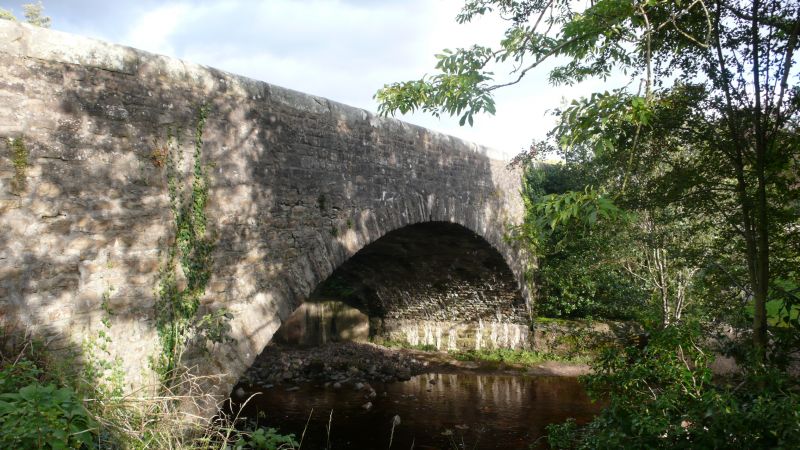
Bridge over Leck Beck, probably late C18th. Sandstone rubble. Single
segmental arch. Solid parapets have rounded tops. Formerly carried main
road, now by-passed by adjacent C20th bridge.
Listing NGR: SD6344776601
External links are from the relevant listing authority and, where applicable, Wikidata. Wikidata IDs may be related buildings as well as this specific building. If you want to add or update a link, you will need to do so by editing the Wikidata entry.


Other nearby listed buildings
