Approximate Location Map
Large Map »
Latitude: 54.1235 / 54°7'24"N
Longitude: -2.6564 / 2°39'23"W
OS Eastings: 357197
OS Northings: 469932
OS Grid: SD571699
Mapcode National: GBR 9NWR.PM
Mapcode Global: WH951.5M97
Plus Code: 9C6V48FV+9C
Entry Name: Church Bank
Listing Date: 4 December 1985
Grade: II
Source: Historic England
Source ID: 1071680
English Heritage Legacy ID: 182376
ID on this website: 101071680
Location: Gressingham, Lancaster, Lancashire, LA2
County: Lancashire
District: Lancaster
Civil Parish: Gressingham
Traditional County: Lancashire
Lieutenancy Area (Ceremonial County): Lancashire
Church of England Parish: Gressingham St John the Evangelist
Church of England Diocese: Blackburn
Tagged with: Building
GRESSINGHAM
SD 56 NE
7/81 Church Bank
GV II
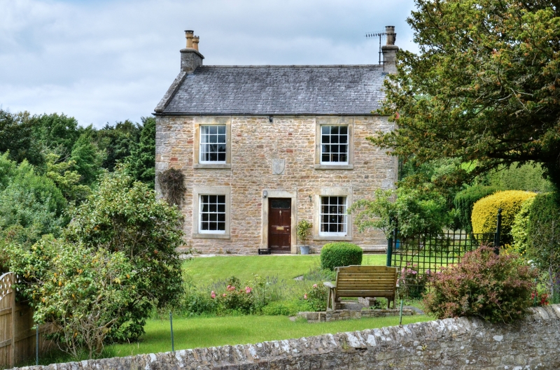
House, 1830. Sandstone rubble with slate roof. Double-depth plan. 2
storeys, 2 bays. 'Windows sashed with glazing bars and plain stone
surrounds. Door, between bays, has plain stone surround. Above is a plaque
in the shape of a shield inscribed: 'REH 1830'. Gable chimneys.
Listing NGR: SD5720069932
External links are from the relevant listing authority and, where applicable, Wikidata. Wikidata IDs may be related buildings as well as this specific building. If you want to add or update a link, you will need to do so by editing the Wikidata entry.


Other nearby listed buildings
