Approximate Location Map
Large Map »
Latitude: 54.1217 / 54°7'18"N
Longitude: -2.6415 / 2°38'29"W
OS Eastings: 358171
OS Northings: 469732
OS Grid: SD581697
Mapcode National: GBR 9NZS.X7
Mapcode Global: WH951.DNDK
Plus Code: 9C6V49C5+MC
Entry Name: Loyne Bridge
Listing Date: 4 October 1967
Grade: II*
Source: Historic England
Source ID: 1071682
English Heritage Legacy ID: 182382
Also known as: Gressingham Bridge
ID on this website: 101071682
Location: Lancaster, Lancashire, LA2
County: Lancashire
District: Lancaster
Civil Parish: Gressingham
Traditional County: Lancashire
Lieutenancy Area (Ceremonial County): Lancashire
Church of England Parish: Hornby with Claughton
Church of England Diocese: Blackburn
Tagged with: Arch bridge Road bridge
GRESSINGHAM
SD 56 NE
7/87 Loyne Bridge
4-10-1967
II*
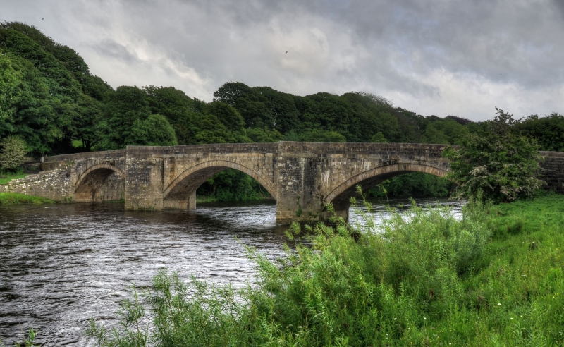
Bridge over River Lune, possibly late medieval. Squared sandstone blocks.
3 segmental arches separated by triangular cutwaters with pedestrian
refuges. Solid parapet has rounded top. Scheduled Ancient Monument. Part
of this bridge is in Hornby-with-Farleton C.P. (q.v.)
Listing NGR: SD5817169732
External links are from the relevant listing authority and, where applicable, Wikidata. Wikidata IDs may be related buildings as well as this specific building. If you want to add or update a link, you will need to do so by editing the Wikidata entry.


Other nearby listed buildings
