Approximate Location Map
Large Map »
Latitude: 53.9836 / 53°59'1"N
Longitude: -2.6673 / 2°40'2"W
OS Eastings: 356338
OS Northings: 454381
OS Grid: SD563543
Mapcode National: GBR 9QTC.BQ
Mapcode Global: WH95T.044D
Plus Code: 9C5VX8MM+F3
Entry Name: Stoops Bridge
Listing Date: 24 February 1986
Grade: II
Source: Historic England
Source ID: 1164348
English Heritage Legacy ID: 182576
ID on this website: 101164348
Location: Abbeystead, Lancaster, Lancashire, LA2
County: Lancashire
District: Lancaster
Civil Parish: Over Wyresdale
Traditional County: Lancashire
Lieutenancy Area (Ceremonial County): Lancashire
Church of England Parish: Over Wyresdale Christ Church
Church of England Diocese: Blackburn
Tagged with: Bridge
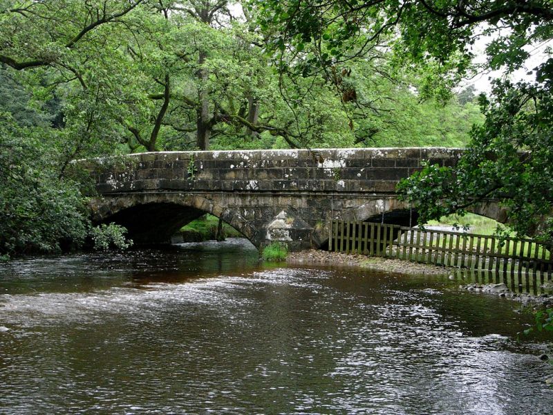
SD 55 SE OVER WYRESDALE ABBEYSTEAD
12/40 Stoops Bridge
-
- II
Bridge over Tarnbrook Wyre, mid C19th, sandstone. 2 segmental arches with
triangular cutwaters. Solid parapet, above band, has rounded top.
Listing NGR: SD5633854381
External links are from the relevant listing authority and, where applicable, Wikidata. Wikidata IDs may be related buildings as well as this specific building. If you want to add or update a link, you will need to do so by editing the Wikidata entry.


Other nearby listed buildings
