Approximate Location Map
Large Map »
Latitude: 53.873 / 53°52'22"N
Longitude: -2.391 / 2°23'27"W
OS Eastings: 374387
OS Northings: 441940
OS Grid: SD743419
Mapcode National: GBR CRRN.4C
Mapcode Global: WH96B.7XN7
Plus Code: 9C5VVJF5+6H
Entry Name: 1, Church Street
Listing Date: 30 September 1976
Grade: II
Source: Historic England
Source ID: 1318126
English Heritage Legacy ID: 182796
ID on this website: 101318126
Location: Clitheroe, Ribble Valley, Lancashire, BB7
County: Lancashire
District: Ribble Valley
Civil Parish: Clitheroe
Built-Up Area: Clitheroe
Traditional County: Lancashire
Lieutenancy Area (Ceremonial County): Lancashire
Church of England Parish: Clitheroe St Mary Magdalene
Church of England Diocese: Blackburn
Tagged with: Building
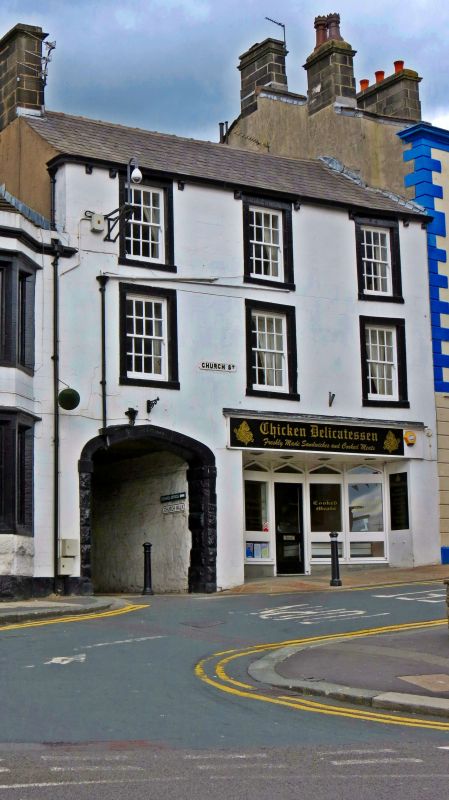
CHURCH STREET
1.
5295
(West Side)
No 1
SD 7441 1/132
II GV
2.
C18 or early C19. 3 storeys, rendered. 3 windows, stone surrounds, later glazing
bars. Arched carriage entry to left, stone head. Modern shop front.
Nos 1 to 23 (odd) form a group with the Parish Church of St Mary Magdelene, Nos 7
to 13 being buildings of local interest only.
Listing NGR: SD7438741940
External links are from the relevant listing authority and, where applicable, Wikidata. Wikidata IDs may be related buildings as well as this specific building. If you want to add or update a link, you will need to do so by editing the Wikidata entry.


Other nearby listed buildings
