Approximate Location Map
Large Map »
Latitude: 53.9457 / 53°56'44"N
Longitude: -2.5201 / 2°31'12"W
OS Eastings: 365959
OS Northings: 450085
OS Grid: SD659500
Mapcode National: GBR BQVT.69
Mapcode Global: WH962.826Y
Plus Code: 9C5VWFWH+7X
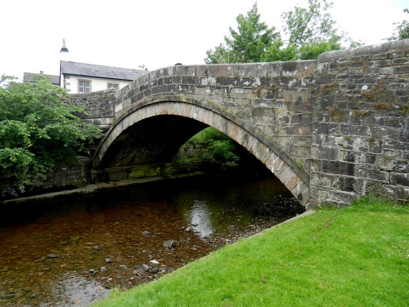
Entry Name: Dunsop Bridge
Listing Date: 16 November 1983
Grade: II
Source: Historic England
Source ID: 1362242
English Heritage Legacy ID: 183053
ID on this website: 101362242
Location: Dunsop Bridge, Ribble Valley, Lancashire, BB7
County: Lancashire
District: Ribble Valley
Civil Parish: Bowland Forest High
Traditional County: Yorkshire
Lieutenancy Area (Ceremonial County): Lancashire
Church of England Parish: Slaidburn St Andrew
Church of England Diocese: Leeds
Tagged with: Road bridge
SD 65 SE BOWLAND FOREST HIGH
9/3 Dunsop Bridge
-
- II
Bridge over the River Dunsop, c.1800. Sandstone ashlar. Single segmental
arch with string course. Solid rounded parapet.
Listing NGR: SD6595950085
External links are from the relevant listing authority and, where applicable, Wikidata. Wikidata IDs may be related buildings as well as this specific building. If you want to add or update a link, you will need to do so by editing the Wikidata entry.


Other nearby listed buildings
