Approximate Location Map
Large Map »
Latitude: 53.781 / 53°46'51"N
Longitude: -2.9207 / 2°55'14"W
OS Eastings: 339425
OS Northings: 432020
OS Grid: SD394320
Mapcode National: GBR 8S1Q.GC
Mapcode Global: WH85J.37F8
Plus Code: 9C5VQ3JH+9P
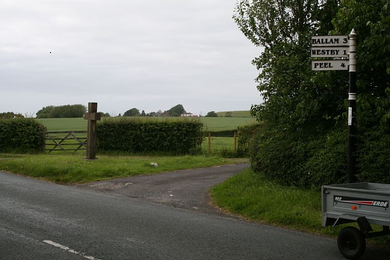
Entry Name: Fox Lane Ends Cross
Listing Date: 11 June 1986
Grade: II
Source: Historic England
Source ID: 1164308
English Heritage Legacy ID: 183653
ID on this website: 101164308
Location: Wrea Green, Fylde, Lancashire, PR4
County: Lancashire
District: Fylde
Civil Parish: Westby-with-Plumptons
Traditional County: Lancashire
Lieutenancy Area (Ceremonial County): Lancashire
Church of England Parish: Ribby cum Wrea St Nicholas
Church of England Diocese: Blackburn
Tagged with: Wayside cross
WESTBY WITH PLUMPTONS STATION ROAD
SD 33 SE
Wrea Green
8/83 Fox Lane Ends Cross
-
- II
Base of wayside cross, with cross erected 1922. Square-shaped boulder, the
exposed part with roughly-chamfered aides. Simple modern cross of punched
stone.
Listing NGR: SD3942532020
External links are from the relevant listing authority and, where applicable, Wikidata. Wikidata IDs may be related buildings as well as this specific building. If you want to add or update a link, you will need to do so by editing the Wikidata entry.


Other nearby listed buildings
