Approximate Location Map
Large Map »
Latitude: 53.887 / 53°53'13"N
Longitude: -2.9545 / 2°57'16"W
OS Eastings: 337359
OS Northings: 443851
OS Grid: SD373438
Mapcode National: GBR 7RTH.4B
Mapcode Global: WH84X.LK9G
Plus Code: 9C5VV2PW+R5
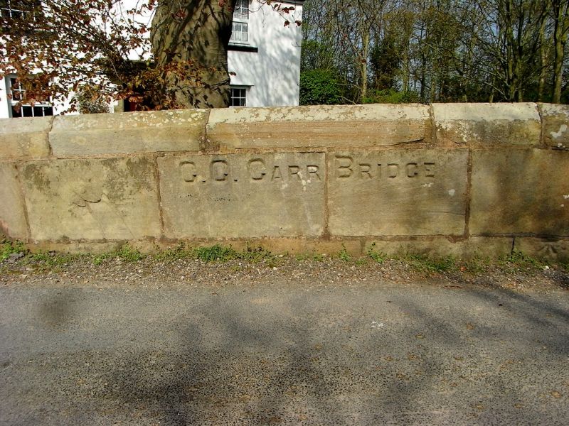
Entry Name: Carr Bridge
Listing Date: 3 October 1984
Grade: II
Source: Historic England
Source ID: 1073071
English Heritage Legacy ID: 185020
ID on this website: 101073071
Location: Sower Carr, Wyre, Lancashire, FY6
County: Lancashire
District: Wyre
Civil Parish: Hambleton
Traditional County: Lancashire
Lieutenancy Area (Ceremonial County): Lancashire
Church of England Parish: Hambleton The Blessed Virgin Mary
Church of England Diocese: Blackburn
Tagged with: Bridge
SD 34 SE HAMBLETON
4/8 Carr Bridge
-
- II
Bridge over drainage channel, probably early C19th. Sandstone ashlar.
Single narrow opening with segmental arch. Solid parapet with string
course and coping with end caps. Part of this bridge is in Stalmine-
with-Staynall CP (q.v.).
Listing NGR: SD3735943851
External links are from the relevant listing authority and, where applicable, Wikidata. Wikidata IDs may be related buildings as well as this specific building. If you want to add or update a link, you will need to do so by editing the Wikidata entry.


Other nearby listed buildings
