Approximate Location Map
Large Map »
Latitude: 53.9199 / 53°55'11"N
Longitude: -2.7703 / 2°46'13"W
OS Eastings: 349506
OS Northings: 447355
OS Grid: SD495473
Mapcode National: GBR 9R33.1L
Mapcode Global: WH84T.FQ1T
Plus Code: 9C5VW69H+WV
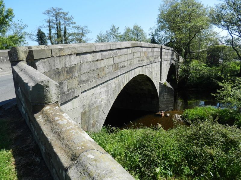
Entry Name: Gubberford Bridge
Listing Date: 9 January 1986
Grade: II
Source: Historic England
Source ID: 1309256
English Heritage Legacy ID: 185409
ID on this website: 101309256
Location: Cabus, Wyre, Lancashire, PR3
County: Lancashire
District: Wyre
Civil Parish: Barnacre-with-Bonds
Built-Up Area: Garstang
Traditional County: Lancashire
Lieutenancy Area (Ceremonial County): Lancashire
Church of England Parish: Barnacre All Saints
Church of England Diocese: Blackburn
Tagged with: Bridge
BARNACRE-WITH-BONDS GUBBERFORD LANE
SD 44 NE
4/22 Gubberford Bridge
-
- II
Bridge over River Wyre, early C19. Sandstone ashlar. 2 segmental arches
with triangular cutwaters. Band below solid parapet with shaped coping.
Part of this bridge is in Cabus C.P. (q.v.)
Listing NGR: SD4950647355
External links are from the relevant listing authority and, where applicable, Wikidata. Wikidata IDs may be related buildings as well as this specific building. If you want to add or update a link, you will need to do so by editing the Wikidata entry.


Other nearby listed buildings
