Approximate Location Map
Large Map »
Latitude: 53.8684 / 53°52'6"N
Longitude: -2.7498 / 2°44'59"W
OS Eastings: 350791
OS Northings: 441612
OS Grid: SD507416
Mapcode National: GBR 9R7Q.G1
Mapcode Global: WH856.Q1R8
Plus Code: 9C5VV792+93
Entry Name: Claughton Lane Bridge (Number 49)
Listing Date: 9 January 1986
Grade: II
Source: Historic England
Source ID: 1361928
English Heritage Legacy ID: 185469
ID on this website: 101361928
Location: Wyre, Lancashire, PR3
County: Lancashire
District: Wyre
Civil Parish: Claughton
Traditional County: Lancashire
Lieutenancy Area (Ceremonial County): Lancashire
Church of England Parish: Garstang St Helen, Churchtown
Church of England Diocese: Blackburn
Tagged with: Bridge
CLAUGHTON NEW LANE
SD 54 SW
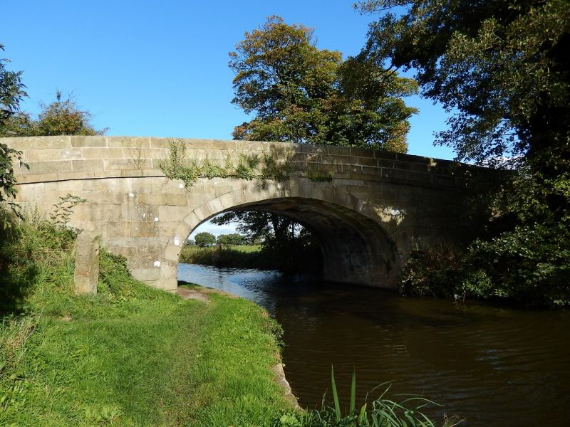
8/78 Claughton Lane Bridge (No.49)
-
- II
Bridge over Lancaster Canal, opened 1797, engineer John Rennie. Squared
sandstone blocks. Single elliptical arch with stepped keystone. Band below
solid parapets with rounded tops.
Listing NGR: SD5079141612
External links are from the relevant listing authority and, where applicable, Wikidata. Wikidata IDs may be related buildings as well as this specific building. If you want to add or update a link, you will need to do so by editing the Wikidata entry.


Other nearby listed buildings
