Approximate Location Map
Large Map »
Latitude: 53.9002 / 53°54'0"N
Longitude: -2.7826 / 2°46'57"W
OS Eastings: 348674
OS Northings: 445178
OS Grid: SD486451
Mapcode National: GBR 9R0B.CM
Mapcode Global: WH850.776C
Plus Code: 9C5VW628+3X
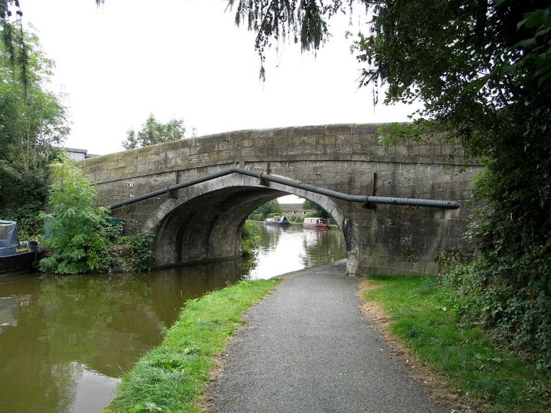
Entry Name: Canal Bridge (Number 63)
Listing Date: 13 April 1978
Grade: II
Source: Historic England
Source ID: 1072868
English Heritage Legacy ID: 185514
ID on this website: 101072868
Location: Garstang, Wyre, Lancashire, PR3
County: Lancashire
District: Wyre
Civil Parish: Garstang
Built-Up Area: Garstang
Traditional County: Lancashire
Lieutenancy Area (Ceremonial County): Lancashire
Church of England Parish: Garstang St Thomas
Church of England Diocese: Blackburn
Tagged with: Bridge
GARSTANG MOSS LANE
SD 44 NE
4/120 Canal Bridge (No.63)
1.3-4-1978
- II
Bridge over Lancaster Canal, opened 1797, engineer John Rennie. Large
sandstone blocks. Single elliptical arch with stepped keystone. Solid
parapet with rounded top.
Listing NGR: SD4867445178
External links are from the relevant listing authority and, where applicable, Wikidata. Wikidata IDs may be related buildings as well as this specific building. If you want to add or update a link, you will need to do so by editing the Wikidata entry.


Other nearby listed buildings
