Approximate Location Map
Large Map »
Latitude: 53.8802 / 53°52'48"N
Longitude: -2.7905 / 2°47'25"W
OS Eastings: 348133
OS Northings: 442960
OS Grid: SD481429
Mapcode National: GBR 8RYK.NS
Mapcode Global: WH850.3QHQ
Plus Code: 9C5VV6J5+3R
Entry Name: Village Cross
Listing Date: 17 April 1967
Last Amended: 9 January 1986
Grade: II
Source: Historic England
Source ID: 1361956
English Heritage Legacy ID: 185518
ID on this website: 101361956
Location: Churchtown, Wyre, Lancashire, PR3
County: Lancashire
District: Wyre
Civil Parish: Kirkland
Traditional County: Lancashire
Lieutenancy Area (Ceremonial County): Lancashire
Church of England Parish: Garstang St Helen, Churchtown
Church of England Diocese: Blackburn
Tagged with: High cross
KIRKLAND CHURCH STREET
SD 44 SE
7/124 Churchtown
17-4-1967
Village Cross (formerly listed as
Pillar in Village Centre)
GV II
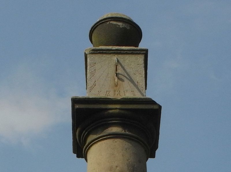
Village cross, later C18, sandstone. Comprises a Tuscan column with
pedestal, surmounted by a block of square plan with a sundial on its
southern face and by a ball finial. It stands on a base of 2 steps of
square plan with nosings.
Listing NGR: SD4813442960
External links are from the relevant listing authority and, where applicable, Wikidata. Wikidata IDs may be related buildings as well as this specific building. If you want to add or update a link, you will need to do so by editing the Wikidata entry.


Other nearby listed buildings
