Approximate Location Map
Large Map »
Latitude: 53.9429 / 53°56'34"N
Longitude: -2.1987 / 2°11'55"W
OS Eastings: 387056
OS Northings: 449662
OS Grid: SD870496
Mapcode National: GBR FQ2V.SB
Mapcode Global: WHB7C.6584
Plus Code: 9C5VWRV2+5G
Entry Name: Turpit Gate House Farmhouse
Listing Date: 29 January 1988
Grade: II
Source: Historic England
Source ID: 1259100
English Heritage Legacy ID: 186198
ID on this website: 101259100
Location: Stock, Pendle, Lancashire, BD23
County: Lancashire
District: Pendle
Civil Parish: Bracewell and Brogden
Traditional County: Yorkshire
Lieutenancy Area (Ceremonial County): Lancashire
Tagged with: Farmhouse
SD 84 NE BRACEWELL
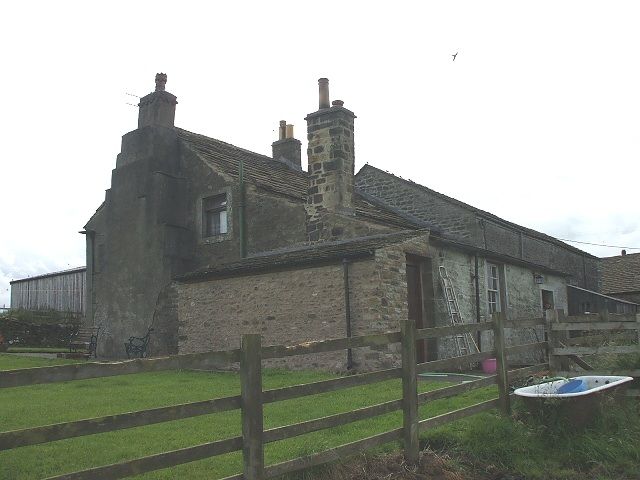
3/59 Turpit Gate House Farmhouse
-
- II
House. C17. Rubble. Stone slate roof. 2 storeys. 2 C17 chamfered window
openings to right in ground floor. Returned dripstone remains on left. One
window similar in first floor. All mullions have been removed. One large sash
window to left. Plain doorway. External stepped chimney breast on gable to
east.
Listing NGR: SD8705649662
External links are from the relevant listing authority and, where applicable, Wikidata. Wikidata IDs may be related buildings as well as this specific building. If you want to add or update a link, you will need to do so by editing the Wikidata entry.


Other nearby listed buildings
