Approximate Location Map
Large Map »
Latitude: 53.9037 / 53°54'13"N
Longitude: -2.1725 / 2°10'21"W
OS Eastings: 388762
OS Northings: 445297
OS Grid: SD887452
Mapcode National: GBR FR89.GC
Mapcode Global: WHB7K.L4PP
Plus Code: 9C5VWR3G+FX
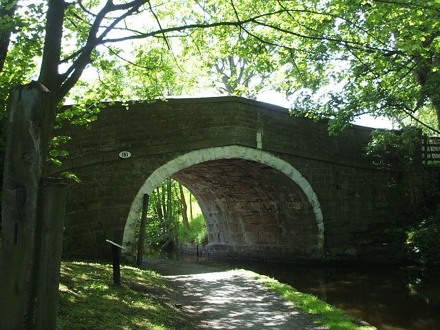
Entry Name: Leeds and Liverpool Canal Salterforth Bridge Number 151
Listing Date: 29 January 1988
Grade: II
Source: Historic England
Source ID: 1272781
English Heritage Legacy ID: 186384
Also known as: Anchor Bridge
ID on this website: 101272781
Location: Salterforth, Pendle, Lancashire, BB18
County: Lancashire
District: Pendle
Civil Parish: Salterforth
Traditional County: Yorkshire
Lieutenancy Area (Ceremonial County): Lancashire
Tagged with: Bridge Architectural structure
SD 84 NE SALTERFORTH LEEDS AND LIVERPOOL CANAL
3/287 Salterforth Bridge No 151
-
GV II
Public road bridge, 1794. Robert Whitworth, engineer. Dressed stone.
Single elliptical arch with rock faced voussoirs. Punched band and solid,
coped parapet. Curved abutment end in piers.
Listing NGR: SD8876245297
External links are from the relevant listing authority and, where applicable, Wikidata. Wikidata IDs may be related buildings as well as this specific building. If you want to add or update a link, you will need to do so by editing the Wikidata entry.


Other nearby listed buildings
