Approximate Location Map
Large Map »
Latitude: 52.6695 / 52°40'10"N
Longitude: -0.7279 / 0°43'40"W
OS Eastings: 486119
OS Northings: 308733
OS Grid: SK861087
Mapcode National: GBR CRL.NSD
Mapcode Global: WHFKN.S5KB
Plus Code: 9C4XM79C+QR
Entry Name: 18 and 20, High Street
Listing Date: 24 November 1971
Grade: II
Source: Historic England
Source ID: 1177727
English Heritage Legacy ID: 186474
ID on this website: 101177727
Location: Oakham, Rutland, LE15
County: Rutland
Civil Parish: Oakham
Built-Up Area: Oakham
Traditional County: Rutland
Lieutenancy Area (Ceremonial County): Rutland
Church of England Parish: Oakham All Saints
Church of England Diocese: Peterborough
Tagged with: Building
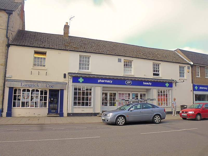
HIGH STREET
1.
1469
(South Side)
Nos 18 & 20
SK 8608 6/42
II
2.
Early C19. 2-storeys with stucco frontage. Modern tile roof. 5 windows
with hung sashes. Upper storey now part of Crown Hotel. Attractive shop
front with reeded pilasters flanking modern windows with glazing bars and
modern doors with 2 glazed fanlights.
Listing NGR: SK8611908733
External links are from the relevant listing authority and, where applicable, Wikidata. Wikidata IDs may be related buildings as well as this specific building. If you want to add or update a link, you will need to do so by editing the Wikidata entry.


Other nearby listed buildings
