Approximate Location Map
Large Map »
Latitude: 52.6697 / 52°40'10"N
Longitude: -0.7282 / 0°43'41"W
OS Eastings: 486099
OS Northings: 308756
OS Grid: SK860087
Mapcode National: GBR CRL.NQ3
Mapcode Global: WHFKN.S5F5
Plus Code: 9C4XM79C+VP
Entry Name: 19, High Street
Listing Date: 24 November 1971
Grade: II
Source: Historic England
Source ID: 1361760
English Heritage Legacy ID: 186485
ID on this website: 101361760
Location: Oakham, Rutland, LE15
County: Rutland
Civil Parish: Oakham
Built-Up Area: Oakham
Traditional County: Rutland
Lieutenancy Area (Ceremonial County): Rutland
Church of England Parish: Oakham All Saints
Church of England Diocese: Peterborough
Tagged with: Building
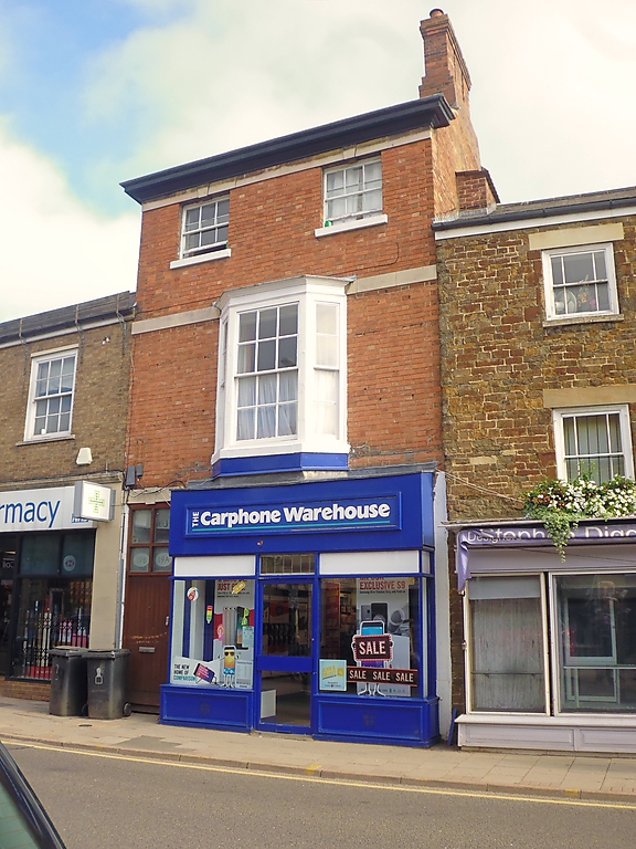
HIGH STREET
1.
1469
(North Side)
No 19
SK 8608 6/57
II GV
2.
Early C19 house. Red brick. Slate roof. Stone band. 3-storeys.
2 windows in plain reveals with straight arches with keystones, which
continue as eaves cornice. 1 splayed bay window with plain frieze
and moulded cornice. Modern shop front with 6-panel door to passage
at side with keystone and blocked fanlight.
Nos 11 to 19 (odd) form a group.
Listing NGR: SK8609908756
External links are from the relevant listing authority and, where applicable, Wikidata. Wikidata IDs may be related buildings as well as this specific building. If you want to add or update a link, you will need to do so by editing the Wikidata entry.


Other nearby listed buildings
