Approximate Location Map
Large Map »
Latitude: 52.6697 / 52°40'10"N
Longitude: -0.7288 / 0°43'43"W
OS Eastings: 486057
OS Northings: 308759
OS Grid: SK860087
Mapcode National: GBR CRL.NKQ
Mapcode Global: WHFKN.S545
Plus Code: 9C4XM79C+VF
Entry Name: 29, High Street
Listing Date: 24 November 1971
Grade: II
Source: Historic England
Source ID: 1073273
English Heritage Legacy ID: 186487
ID on this website: 101073273
Location: Oakham, Rutland, LE15
County: Rutland
Civil Parish: Oakham
Built-Up Area: Oakham
Traditional County: Rutland
Lieutenancy Area (Ceremonial County): Rutland
Church of England Parish: Oakham All Saints
Church of England Diocese: Peterborough
Tagged with: Building
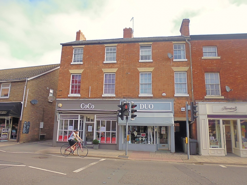
HIGH STREET
1.
1469
(North Side)
No 29
SK 8608 6/61
II GV
2.
Early C19 house. Red brick. Slate roof. 3-storeys. 4 windows
in plain reveals, stone flat arches. Wood eaves cornice on paired
modillions. Modern ground floor shop. Flat arched doorway with
chamfered architrave to right.
Nos 27 and 29 form a group.
Listing NGR: SK8605708759
External links are from the relevant listing authority and, where applicable, Wikidata. Wikidata IDs may be related buildings as well as this specific building. If you want to add or update a link, you will need to do so by editing the Wikidata entry.


Other nearby listed buildings
