Approximate Location Map
Large Map »
Latitude: 52.6702 / 52°40'12"N
Longitude: -0.7271 / 0°43'37"W
OS Eastings: 486172
OS Northings: 308816
OS Grid: SK861088
Mapcode National: GBR CRL.P00
Mapcode Global: WHFKN.S4YS
Plus Code: 9C4XM7CF+35
Entry Name: 11, Market Place
Listing Date: 24 November 1971
Grade: II
Source: Historic England
Source ID: 1073280
English Heritage Legacy ID: 186500
ID on this website: 101073280
Location: Oakham, Rutland, LE15
County: Rutland
Civil Parish: Oakham
Built-Up Area: Oakham
Traditional County: Rutland
Lieutenancy Area (Ceremonial County): Rutland
Church of England Parish: Oakham All Saints
Church of England Diocese: Peterborough
Tagged with: Building
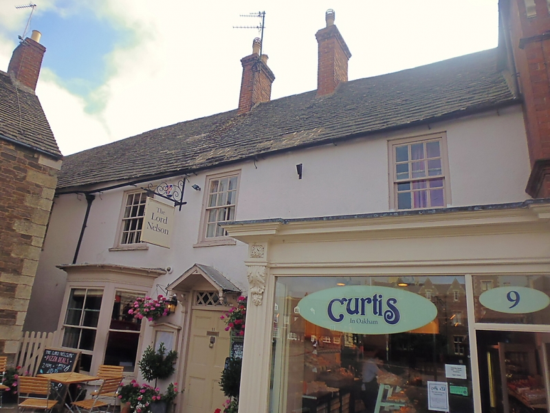
MARKET PLACE
1.
1469
No 11
SK 8608 6/71
II
2.
Small early C18 house of 2-storeys. Stone slate roof. Cement rendered.
3 windows, flat arches, flush frames, glazing bars, 1 ground floor bay
with modern glazing. Early C19 6-panel door under rectangular glazed
fanlight and small pediment. The neighbouring property encroaches on
the front elevation to the right.
Listing NGR: SK8617208816
External links are from the relevant listing authority and, where applicable, Wikidata. Wikidata IDs may be related buildings as well as this specific building. If you want to add or update a link, you will need to do so by editing the Wikidata entry.


Other nearby listed buildings
