Approximate Location Map
Large Map »
Latitude: 52.6704 / 52°40'13"N
Longitude: -0.7274 / 0°43'38"W
OS Eastings: 486153
OS Northings: 308832
OS Grid: SK861088
Mapcode National: GBR CRL.GYK
Mapcode Global: WHFKN.S4TN
Plus Code: 9C4XM7CF+43
Entry Name: 17, Market Place
Listing Date: 24 November 1971
Grade: II
Source: Historic England
Source ID: 1361783
English Heritage Legacy ID: 186502
ID on this website: 101361783
Location: Oakham, Rutland, LE15
County: Rutland
Civil Parish: Oakham
Built-Up Area: Oakham
Traditional County: Rutland
Lieutenancy Area (Ceremonial County): Rutland
Church of England Parish: Oakham All Saints
Church of England Diocese: Peterborough
Tagged with: Building
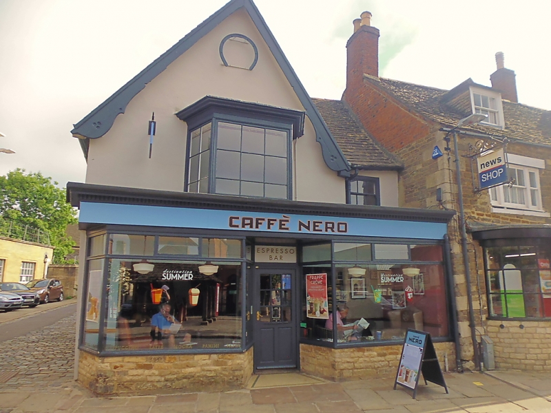
MARKET PLACE
1.
1469
SK 8608 6/69 No 17
II
2.
Former Horse-Shoe Cafe. Probably Cl7 origin. Cement rendered 2-storey
building in rubble. Steep pitched stone slate roof. Bargeboards. C19
shop front. Office extension to rear in coursed rubble.
Listing NGR: SK8615308832
External links are from the relevant listing authority and, where applicable, Wikidata. Wikidata IDs may be related buildings as well as this specific building. If you want to add or update a link, you will need to do so by editing the Wikidata entry.


Other nearby listed buildings
