Approximate Location Map
Large Map »
Latitude: 52.6298 / 52°37'47"N
Longitude: -0.6614 / 0°39'41"W
OS Eastings: 490696
OS Northings: 304402
OS Grid: SK906044
Mapcode National: GBR DTL.1M8
Mapcode Global: WHGM0.T578
Plus Code: 9C4XJ8HQ+WC
Entry Name: Pair of Gatepiers and Wall at Lyndon Hall
Listing Date: 29 June 1984
Grade: II
Source: Historic England
Source ID: 1361484
English Heritage Legacy ID: 186995
ID on this website: 101361484
Location: Lyndon, Rutland, LE15
County: Rutland
Civil Parish: Lyndon
Traditional County: Rutland
Lieutenancy Area (Ceremonial County): Rutland
Church of England Parish: Lyndon St Martin
Church of England Diocese: Peterborough
Tagged with: Gatepost
LYNDON
SK 90 SW CHURCH ROAD (South Side)
6/156 Pair of gatepiers and wall
at Lyndon Hall
GV
II
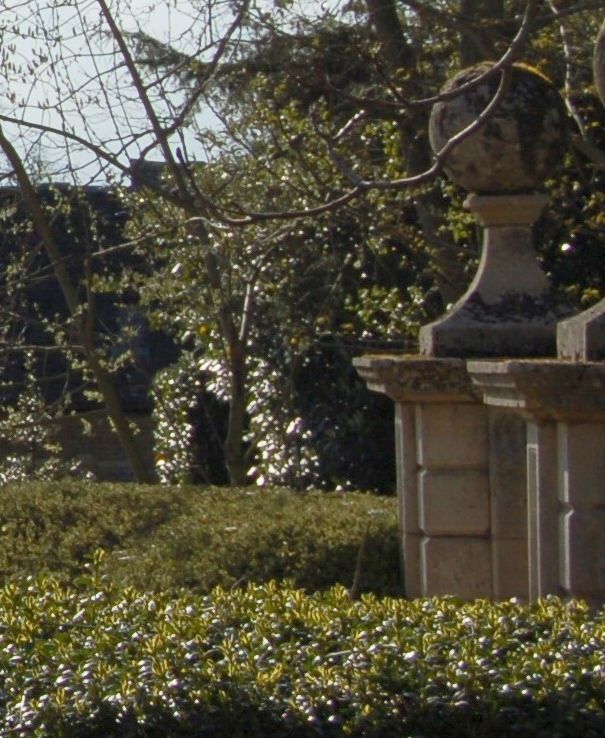
Pair of gatepiers and wall. Mid C19. Ashlar and coursed rubble stone.
Pair of rusticated carriage gate piers with curving top surmounted by
a stone ball. Extending from each a curving forecourt wall with stone
coping c1½m high.
Listing NGR: SK9069604402
External links are from the relevant listing authority and, where applicable, Wikidata. Wikidata IDs may be related buildings as well as this specific building. If you want to add or update a link, you will need to do so by editing the Wikidata entry.


Other nearby listed buildings
