Approximate Location Map
Large Map »
Latitude: 52.6324 / 52°37'56"N
Longitude: -0.5504 / 0°33'1"W
OS Eastings: 498203
OS Northings: 304836
OS Grid: SK982048
Mapcode National: GBR DTJ.ZM1
Mapcode Global: WHGM2.J338
Plus Code: 9C4XJCJX+XR
Entry Name: 31, High Street
Listing Date: 6 June 1961
Grade: II
Source: Historic England
Source ID: 1115760
English Heritage Legacy ID: 187176
ID on this website: 101115760
Location: Ketton, Rutland, PE9
County: Rutland
Civil Parish: Ketton
Built-Up Area: Ketton
Traditional County: Rutland
Lieutenancy Area (Ceremonial County): Rutland
Church of England Parish: Ketton St Mary the Virgin
Church of England Diocese: Peterborough
Tagged with: Building
SK 9804-9904 KETTON HIGH STREET
15/84 (south-east side)
6.6.61 No 31
GV
II
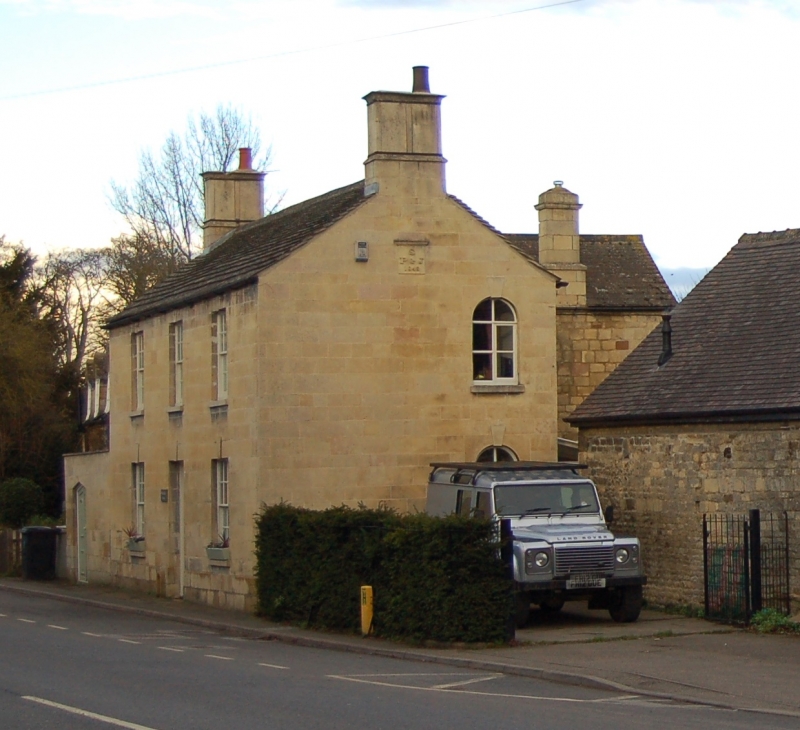
House, dated 1848 S over P J, of ashlar with Collyweston stone slate roof and stone
end stacks. Two storeys, 3 window range, double fronted. Central panelled door
with rectangular fanlight above. 16-pane sash windows. Keystones over openings.
Two round-headed windows with keystones in south gable end.
Listing NGR: SK9820304836
External links are from the relevant listing authority and, where applicable, Wikidata. Wikidata IDs may be related buildings as well as this specific building. If you want to add or update a link, you will need to do so by editing the Wikidata entry.


Other nearby listed buildings
