Approximate Location Map
Large Map »
Latitude: 52.6281 / 52°37'41"N
Longitude: -0.553 / 0°33'10"W
OS Eastings: 498037
OS Northings: 304356
OS Grid: SK980043
Mapcode National: GBR DTQ.C04
Mapcode Global: WHGM2.G6WK
Plus Code: 9C4XJCHW+6Q
Entry Name: Jubilee Fountain
Listing Date: 17 December 1984
Grade: II
Source: Historic England
Source ID: 1115693
English Heritage Legacy ID: 187192
ID on this website: 101115693
Location: Ketton, Rutland, PE9
County: Rutland
Civil Parish: Ketton
Built-Up Area: Ketton
Traditional County: Rutland
Lieutenancy Area (Ceremonial County): Rutland
Church of England Parish: Ketton St Mary the Virgin
Church of England Diocese: Peterborough
Tagged with: Fountain
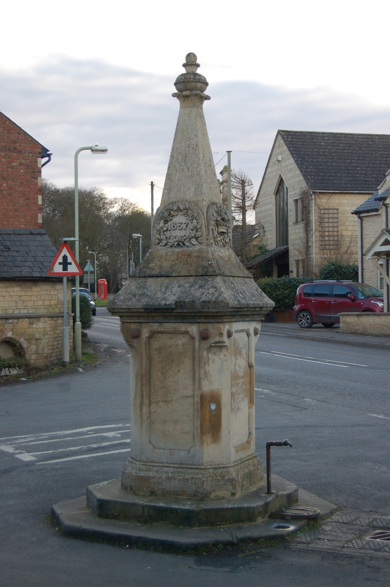
SK 9804-9904 KETTON STOCKS HILL
15/103
Jubilee Fountain
GV
II
Monument and water tap, 1887. Of ashlar. Square base with chamfered angles
carrying spire and finial. Inscribed 1837/VR/JUBILEE/1887 in panels with decorative
foliage. Water tap beneath.
Listing NGR: SK9803704356
External links are from the relevant listing authority and, where applicable, Wikidata. Wikidata IDs may be related buildings as well as this specific building. If you want to add or update a link, you will need to do so by editing the Wikidata entry.


Other nearby listed buildings
