Approximate Location Map
Large Map »
Latitude: 52.6872 / 52°41'13"N
Longitude: -0.4677 / 0°28'3"W
OS Eastings: 503670
OS Northings: 311047
OS Grid: TF036110
Mapcode National: GBR FVD.GL8
Mapcode Global: WHGLQ.SQG9
Plus Code: 9C4XMGPJ+VW
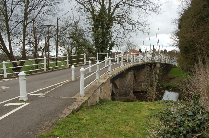
Entry Name: Bridge over River Gwash
Listing Date: 6 June 1961
Grade: II
Source: Historic England
Source ID: 1073811
English Heritage Legacy ID: 187225
ID on this website: 101073811
Location: Ryhall, Rutland, PE9
County: Rutland
Civil Parish: Ryhall
Built-Up Area: Ryhall
Traditional County: Rutland
Lieutenancy Area (Ceremonial County): Rutland
Church of England Parish: Ryhall St John Evangelist
Church of England Diocese: Peterborough
Tagged with: Bridge
TF 0211-0311 RYHALL BRIDGE STREET
8/137
6.6.61 Bridge over River Gwash
GV
II
Bridge, C17, of squared stone and ashlar. 3 semi-circular arches, recessed.
Pointed cut-waters to west. Iron railing C19.
Listing NGR: TF0367011047
External links are from the relevant listing authority and, where applicable, Wikidata. Wikidata IDs may be related buildings as well as this specific building. If you want to add or update a link, you will need to do so by editing the Wikidata entry.


Other nearby listed buildings
