Approximate Location Map
Large Map »
Latitude: 52.6906 / 52°41'26"N
Longitude: -0.6314 / 0°37'52"W
OS Eastings: 492602
OS Northings: 311205
OS Grid: SK926112
Mapcode National: GBR DSV.963
Mapcode Global: WHGLN.8MLN
Plus Code: 9C4XM9R9+7F
Entry Name: 2, Blacksmiths Lane
Listing Date: 18 September 1984
Grade: II
Source: Historic England
Source ID: 1073768
English Heritage Legacy ID: 187324
ID on this website: 101073768
Location: Exton, Rutland, LE15
County: Rutland
Civil Parish: Exton and Horn
Built-Up Area: Exton
Traditional County: Rutland
Lieutenancy Area (Ceremonial County): Rutland
Church of England Parish: Exton with Horn St Peter and St Paul
Church of England Diocese: Peterborough
Tagged with: Building
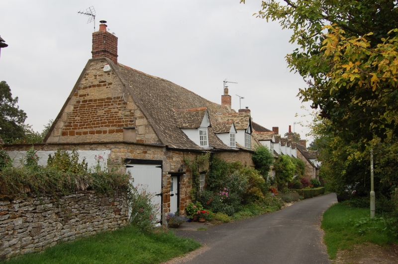
SK 9211 - 9311 EXTON BLACKSMITHS LANE (north side)
5/41 No. 2
GV II
Terraced cottage, possibly early C18. Sandstone & ironstone coursed
rubble with stone tiled roof. 1½ storeys, a single cell, with door to
left. Casement window with flat timber lintel. Coped gable to left with
stepped stones and angle quoins. Roofed with No. 4 but walls of
separate build.
Listing NGR: SK9260211205
External links are from the relevant listing authority and, where applicable, Wikidata. Wikidata IDs may be related buildings as well as this specific building. If you want to add or update a link, you will need to do so by editing the Wikidata entry.


Other nearby listed buildings
