Approximate Location Map
Large Map »
Latitude: 52.6584 / 52°39'30"N
Longitude: -0.6699 / 0°40'11"W
OS Eastings: 490060
OS Northings: 307568
OS Grid: SK900075
Mapcode National: GBR DT5.CFW
Mapcode Global: WHGLT.PF5W
Plus Code: 9C4XM85J+82
Entry Name: The Cottage
Listing Date: 14 June 1954
Grade: II
Source: Historic England
Source ID: 1073714
English Heritage Legacy ID: 187400
ID on this website: 101073714
Location: Upper Hambleton, Rutland, LE15
County: Rutland
Civil Parish: Hambleton
Traditional County: Rutland
Lieutenancy Area (Ceremonial County): Rutland
Church of England Parish: Hambleton
Church of England Diocese: Peterborough
Tagged with: Cottage
SK 90 NW HAMBLETON
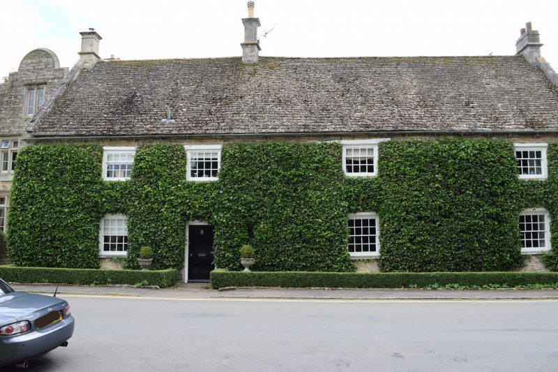
The Cottage
8/114
14.6.54
GV II
Large house, probably early C18. Coursed rubble with stone tiled roof
and coped gables. Moulded stone chimney stacks. 2 storeys, 3 unit
plan with door left of centre of elevation, opening on to a through
passage behind the stack. Small fire window and 3 16-light sash
windows to ground floor, 12-light sashes above. All openings including
the door, have flat timber lintels.
Listing NGR: SK9006007568
External links are from the relevant listing authority and, where applicable, Wikidata. Wikidata IDs may be related buildings as well as this specific building. If you want to add or update a link, you will need to do so by editing the Wikidata entry.


Other nearby listed buildings
