Approximate Location Map
Large Map »
Latitude: 52.6006 / 52°36'2"N
Longitude: -0.7322 / 0°43'55"W
OS Eastings: 485963
OS Northings: 301072
OS Grid: SK859010
Mapcode National: GBR CSC.V0X
Mapcode Global: WHFKV.QWJN
Plus Code: 9C4XJ729+74
Entry Name: Gate Piers at Ayston Hall
Listing Date: 5 August 1986
Grade: II
Source: Historic England
Source ID: 1361554
English Heritage Legacy ID: 187467
ID on this website: 101361554
Location: Ayston, Rutland, LE15
County: Rutland
Civil Parish: Ayston
Traditional County: Rutland
Lieutenancy Area (Ceremonial County): Rutland
Church of England Parish: Uppingham St Peter and St Paul
Church of England Diocese: Peterborough
Tagged with: Gatepost
AYSTON AYSTON
SK 80 SE
2/4
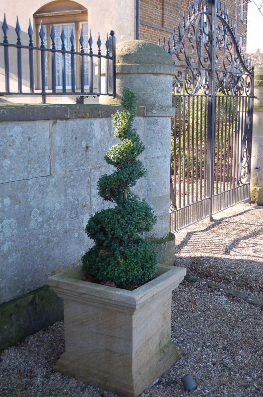
Gate Piers at Ayston
Hall
GV
II
Gate piers. Early C19. Rubble, ashlar. Plain with rounded central and side
piers attached by curving stone wall.
Listing NGR: SK8596301072
External links are from the relevant listing authority and, where applicable, Wikidata. Wikidata IDs may be related buildings as well as this specific building. If you want to add or update a link, you will need to do so by editing the Wikidata entry.


Other nearby listed buildings
