Approximate Location Map
Large Map »
Latitude: 52.6138 / 52°36'49"N
Longitude: -0.7149 / 0°42'53"W
OS Eastings: 487108
OS Northings: 302560
OS Grid: SK871025
Mapcode National: GBR CSD.02T
Mapcode Global: WHFKV.ZKQJ
Plus Code: 9C4XJ77P+G2
Entry Name: 17, Main Street
Listing Date: 5 August 1986
Grade: II
Source: Historic England
Source ID: 1073672
English Heritage Legacy ID: 187502
ID on this website: 101073672
Location: Preston, Rutland, LE15
County: Rutland
Civil Parish: Preston
Traditional County: Rutland
Lieutenancy Area (Ceremonial County): Rutland
Church of England Parish: Preston St Peter and St Paul
Church of England Diocese: Peterborough
Tagged with: Building
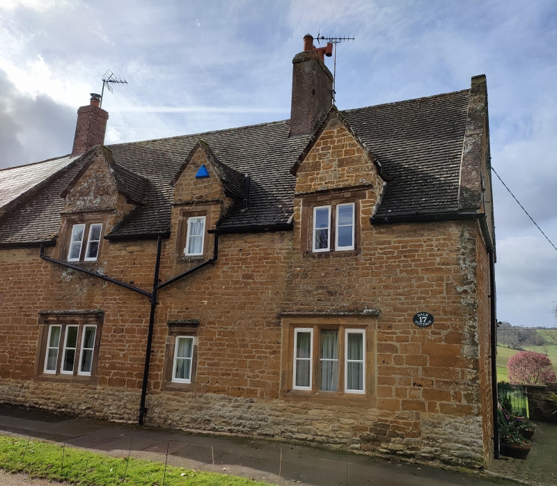
PRESTON MAIN STREET, West Side
SK 8602 and SK 8702
4/23
No 17
GV II
Cottage. C18. Rubble, stone tiles. 1½ storeys. 3 stone dormers: 2:1:2 lights.
3 stone mullioned windows on ground floor: 3:1:3: casements. Wooden panelled door
to left. Brick and render stack off-centre.
Listing NGR: SK8710802560
External links are from the relevant listing authority and, where applicable, Wikidata. Wikidata IDs may be related buildings as well as this specific building. If you want to add or update a link, you will need to do so by editing the Wikidata entry.


Other nearby listed buildings
