Approximate Location Map
Large Map »
Latitude: 52.7826 / 52°46'57"N
Longitude: -1.1792 / 1°10'45"W
OS Eastings: 455455
OS Northings: 320870
OS Grid: SK554208
Mapcode National: GBR 8KN.GPQ
Mapcode Global: WHDHQ.VBM4
Plus Code: 9C4WQRMC+28
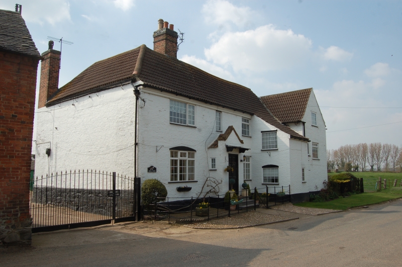
Entry Name: Hall Farmhouse
Listing Date: 15 March 1984
Grade: II
Source: Historic England
Source ID: 1074597
English Heritage Legacy ID: 189291
ID on this website: 101074597
Location: Cotes, Charnwood, Leicestershire, LE12
County: Leicestershire
District: Charnwood
Civil Parish: Cotes
Traditional County: Leicestershire
Lieutenancy Area (Ceremonial County): Leicestershire
Church of England Parish: Prestwold St Andrew
Church of England Diocese: Leicester
Tagged with: Farmhouse
SK 52 SE COTES STANFORD LANE
1/33 Hall Farmhouse
II
Farmhouse with facade of mid C18, modified later, but concealing earlier core.
T. plan, 2 storeys. Brick with rubble plinth chamfered to main facade, pantiled'
roof. Main facade has central door in gable porch backing onto stack, renewed
windows with cambered heads, and to right, a pent roofed projection for the
staircase. The gabled wing has various brick stacks and has been extended
further to NE in C19. Internally, it is clear that this wing forms the earliest
part of the house (early C17) with substantial remains of timber framing visible
in 1st floor partition walls: collar beams with arch bracing and vertical
studding. Wall plate visible in SE wall. Interior gable of main range also
timbered. A ground floor room in the wing has a well-beamed ceiling and
bressumer for inglenook, both with run-out chamfers, and there is a small room
with close-spaced and roughly shaped timber beams. An upper room in the main
range also contains a large ceiling beam with run-out chamfer. Adjoining
the house to the rear is a pump with wood case and decorated leadwork to spout,
inscribed W.H. 1777'.
Listing NGR: SK5545520870
External links are from the relevant listing authority and, where applicable, Wikidata. Wikidata IDs may be related buildings as well as this specific building. If you want to add or update a link, you will need to do so by editing the Wikidata entry.


Other nearby listed buildings
