Approximate Location Map
Large Map »
Latitude: 52.7883 / 52°47'17"N
Longitude: -1.143 / 1°8'34"W
OS Eastings: 457893
OS Northings: 321532
OS Grid: SK578215
Mapcode National: GBR 8KP.5V8
Mapcode Global: WHDHR.D5YS
Plus Code: 9C4WQVQ4+8R
Entry Name: Stable Block, Prestwold Hall
Listing Date: 15 March 1984
Grade: II
Source: Historic England
Source ID: 1074564
English Heritage Legacy ID: 189314
ID on this website: 101074564
Location: Prestwold, Charnwood, Leicestershire, LE12
County: Leicestershire
District: Charnwood
Civil Parish: Prestwold
Traditional County: Leicestershire
Lieutenancy Area (Ceremonial County): Leicestershire
Church of England Parish: Prestwold St Andrew
Church of England Diocese: Leicester
Tagged with: Stable
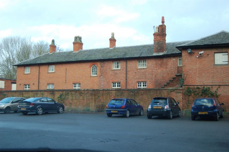
SK 52 SE PRESTWOLD PRESTWOLD HALL
1/56 Stable Block, Prestwold Hall
GV II
Stable block, forming the North side of stable courtyard, c1840. Brick, with
slate roof. A low 2 storeys, 6 bays with 2 central shallow arched carriage
entrances, and various windows with stone sills and gauged brick heads.
Listing NGR: SK5789321532
External links are from the relevant listing authority and, where applicable, Wikidata. Wikidata IDs may be related buildings as well as this specific building. If you want to add or update a link, you will need to do so by editing the Wikidata entry.


Other nearby listed buildings
