Approximate Location Map
Large Map »
Latitude: 52.6524 / 52°39'8"N
Longitude: -0.479 / 0°28'44"W
OS Eastings: 502986
OS Northings: 307159
OS Grid: TF029071
Mapcode National: GBR FVR.RPH
Mapcode Global: WHGLX.ML3G
Plus Code: 9C4XMG2C+X9
Entry Name: 11 and 12, High Street
Listing Date: 22 May 1954
Grade: II*
Source: Historic England
Source ID: 1062227
English Heritage Legacy ID: 193544
ID on this website: 101062227
Location: Stamford, South Kesteven, Lincolnshire, PE9
County: Lincolnshire
District: South Kesteven
Civil Parish: Stamford
Built-Up Area: Stamford
Traditional County: Lincolnshire
Lieutenancy Area (Ceremonial County): Lincolnshire
Church of England Parish: Stamford St Mary
Church of England Diocese: Lincoln
Tagged with: Building
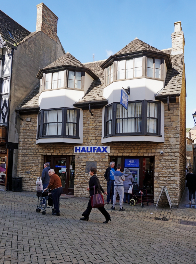
1.
1671 HIGH STREET
(North Side)
Nos 11 & 12
TF 0207 1/93 22.5.54.
II* GV
2.
C17 and later. 2 storeys with 2-storey hexagonal bays rising to form big 3-window
dormers under peaked roofs. Stone slate roof. Late Cl9 glazing, moulded eaves
cornice. 2 modern shop fronts.
No 4 and Nos 6 to 12 (consec) form a group.
Listing NGR: TF0298607159
External links are from the relevant listing authority and, where applicable, Wikidata. Wikidata IDs may be related buildings as well as this specific building. If you want to add or update a link, you will need to do so by editing the Wikidata entry.


Other nearby listed buildings
