Approximate Location Map
Large Map »
Latitude: 52.6519 / 52°39'6"N
Longitude: -0.4796 / 0°28'46"W
OS Eastings: 502946
OS Northings: 307103
OS Grid: TF029071
Mapcode National: GBR FVR.RK8
Mapcode Global: WHGLX.LLTV
Plus Code: 9C4XMG2C+Q4
Entry Name: 70, High Street
Listing Date: 26 July 1974
Grade: II
Source: Historic England
Source ID: 1062238
English Heritage Legacy ID: 193570
ID on this website: 101062238
Location: Stamford, South Kesteven, Lincolnshire, PE9
County: Lincolnshire
District: South Kesteven
Civil Parish: Stamford
Built-Up Area: Stamford
Traditional County: Lincolnshire
Lieutenancy Area (Ceremonial County): Lincolnshire
Church of England Parish: Stamford St Mary
Church of England Diocese: Lincoln
Tagged with: Building
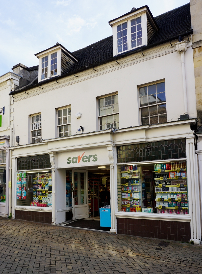
1.
1671 HIGH STREET
(South Side)
No 70
TF 0207 1/456
II GV
2.
C18. 2 storeys and attics. Rendered. Stone slate roof. 2 hipped dormers, casements
with glazing bars. Moulded eaves cornice, 3 windows, double-hung sashes with
glazing bars. Early C20 shop front.
Nos 53 to 59 (consec), Nos 61 to 65 (consec) & Nos 68 to 73 (consec) form a group.
Listing NGR: TF0294607103
External links are from the relevant listing authority and, where applicable, Wikidata. Wikidata IDs may be related buildings as well as this specific building. If you want to add or update a link, you will need to do so by editing the Wikidata entry.


Other nearby listed buildings
