Approximate Location Map
Large Map »
Latitude: 52.648 / 52°38'52"N
Longitude: -0.4766 / 0°28'35"W
OS Eastings: 503159
OS Northings: 306672
OS Grid: TF031066
Mapcode National: GBR FVS.SDQ
Mapcode Global: WHGLX.NP7V
Plus Code: 9C4XJGXF+58
Entry Name: 26, St Martin's
Listing Date: 26 April 1974
Grade: II
Source: Historic England
Source ID: 1360444
English Heritage Legacy ID: 193682
ID on this website: 101360444
Location: Newtown, South Kesteven, Lincolnshire, PE9
County: Lincolnshire
District: South Kesteven
Civil Parish: Stamford
Built-Up Area: Stamford
Traditional County: Northamptonshire
Lieutenancy Area (Ceremonial County): Lincolnshire
Tagged with: Building
1.
1671
TF 0306
2/211
ST MARTIN'S
(East Side)
No 26
II
GV
2.
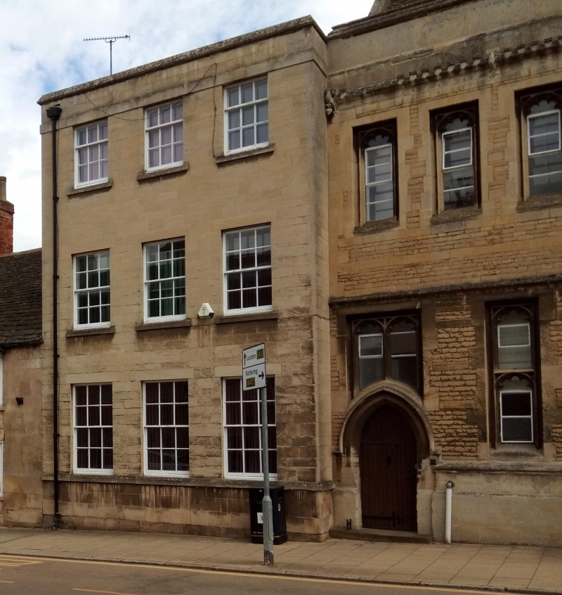
Nos 26 to 33 are all parts of the Stamford Girls' High School. 3 storey modern
building in Georgian style. Parapet. 3 windows, hung sashes with glazing bars.
Joined cills on ground floor. Listed solely as part of the main school building
- see nos 27-29.
Nos 18 to 38(consec) and the Church of St Martin form a group.
Listing NGR: TF0315906672
External links are from the relevant listing authority and, where applicable, Wikidata. Wikidata IDs may be related buildings as well as this specific building. If you want to add or update a link, you will need to do so by editing the Wikidata entry.


Other nearby listed buildings
