Approximate Location Map
Large Map »
Latitude: 52.6476 / 52°38'51"N
Longitude: -0.4764 / 0°28'34"W
OS Eastings: 503179
OS Northings: 306627
OS Grid: TF031066
Mapcode National: GBR FVS.SHG
Mapcode Global: WHGLX.NQC5
Plus Code: 9C4XJGXF+2F
Entry Name: 32, St Martin's
Listing Date: 22 May 1954
Grade: II
Source: Historic England
Source ID: 1062166
English Heritage Legacy ID: 193686
ID on this website: 101062166
Location: Newtown, South Kesteven, Lincolnshire, PE9
County: Lincolnshire
District: South Kesteven
Civil Parish: Stamford
Built-Up Area: Stamford
Traditional County: Northamptonshire
Lieutenancy Area (Ceremonial County): Lincolnshire
Tagged with: Building
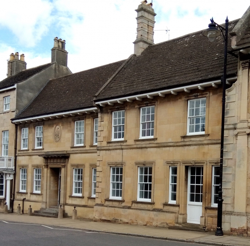
1.
1671
TF 0306
2/215
22.5.54
ST MARTIN'S
(East Side)
No 52
II
GV
2.
Two storeys in ashlar. 3 windows, irregular, stone surrounds with acanthus keystone,
double-hung sashes with glazing bars, Wood modillion eaves cornice. Half-glazed
door with similar keystone and architrave.
Nos 18 to 38 (consec) and the Church of St Martin form a group.
Listing NGR: TF0317906627
External links are from the relevant listing authority and, where applicable, Wikidata. Wikidata IDs may be related buildings as well as this specific building. If you want to add or update a link, you will need to do so by editing the Wikidata entry.


Other nearby listed buildings
