Approximate Location Map
Large Map »
Latitude: 52.9525 / 52°57'9"N
Longitude: -0.7262 / 0°43'34"W
OS Eastings: 485678
OS Northings: 340217
OS Grid: SK856402
Mapcode National: GBR CN3.WRW
Mapcode Global: WHFJ9.T1DW
Plus Code: 9C4XX73F+2G
Entry Name: Cross
Listing Date: 16 August 1984
Grade: II
Source: Historic England
Source ID: 1062904
English Heritage Legacy ID: 193890
ID on this website: 101062904
Location: Allington, South Kesteven, Lincolnshire, NG32
County: Lincolnshire
District: South Kesteven
Civil Parish: Allington
Built-Up Area: Allington
Traditional County: Lincolnshire
Lieutenancy Area (Ceremonial County): Lincolnshire
Church of England Parish: West Allington Holy Trinity
Church of England Diocese: Lincoln
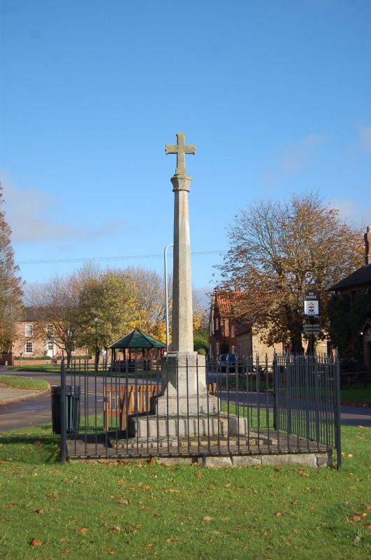
SK 8440-8540 ALLINGTON MAIN STREET
(village green)
11/1 Cross
G.V. II
Cross, C15, C20 limestone. Plinth of 3 steps, high octagonal base with
broaches, part of shaft C15, remainder C20. C15 octagonal knop with
C20 cross above.
Listing NGR: SK8567840217
External links are from the relevant listing authority and, where applicable, Wikidata. Wikidata IDs may be related buildings as well as this specific building. If you want to add or update a link, you will need to do so by editing the Wikidata entry.


Other nearby listed buildings
