Approximate Location Map
Large Map »
Latitude: 51.4525 / 51°27'9"N
Longitude: 0.1753 / 0°10'30"E
OS Eastings: 551240
OS Northings: 174862
OS Grid: TQ512748
Mapcode National: GBR ST.6VH
Mapcode Global: VHHNT.0R0B
Plus Code: 9F32F53G+24
Entry Name: Brooklands
Listing Date: 20 May 1952
Grade: II
Source: Historic England
Source ID: 1188215
English Heritage Legacy ID: 198644
ID on this website: 101188215
Location: Crayford, Bexley, London, DA1
County: London
District: Bexley
Electoral Ward/Division: Crayford
Parish: Non Civil Parish
Built-Up Area: Bexley
Traditional County: Kent
Lieutenancy Area (Ceremonial County): Greater London
Church of England Parish: Crayford St Paulinus
Church of England Diocese: Rochester
Tagged with: Building
BEXLEY LANE
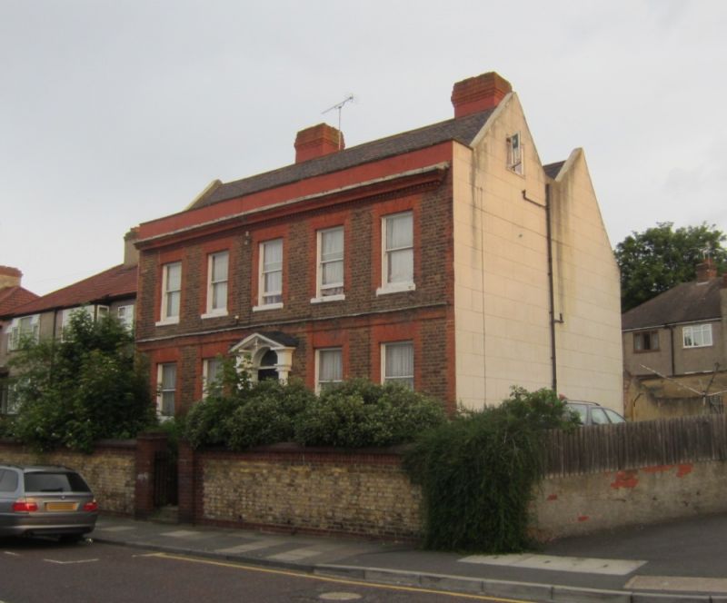
1.
5005
Crayford
TQ 5174 11/2
(No 38 Brooklands) (3rooklands)
20.5.52.
II
2.
C18. Two storeys. Five windows. Brown brick with red dressings, quoins,
stringcourse, and dentilled cornice. Parapet, tiled 'H' roof. Glazing bars
missing. Doorway at head of 8 steps, with engaged Doric columns, open pediment,
semi-circular fanlight.
Listing NGR: TQ5124074862
External links are from the relevant listing authority and, where applicable, Wikidata. Wikidata IDs may be related buildings as well as this specific building. If you want to add or update a link, you will need to do so by editing the Wikidata entry.


Other nearby listed buildings
